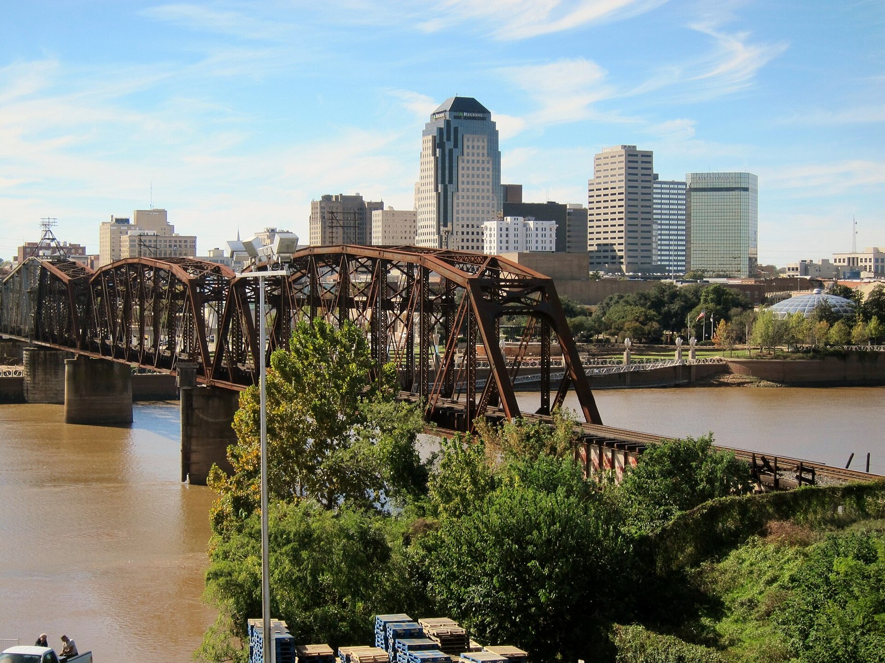
Shreveport source photograph

Outdoors

Wildlife viewing and birding near Shreveport

Refuges, lakes and wild areas near Shreveport for wildlife viewing and birdwatching.

28places to see wildlife
7 mito the closest
4within 30 miles

Good to know: Early mornings and evenings are best for wildlife; bring binoculars and keep a respectful distance.

Closest picks

1

Red River National Wildlife Refuge

7 mi east · Fish and Wildlife Service

The Red River National Wildlife Refuge (NWR) was created legislatively by the Red River National Wildlife Refuge Act - signed into law on October 13, 2000. The first land purchase was made in August 2002 consisting of 1,377 acres.

2

Wallace Lake

12 mi southeast · US Army Corps of Engineers

Wallace Lake, LA, which is operated by the Corps, has facilities at the dam for bank fishing.

3

Caddo Lake

18 mi northwest · US Army Corps of Engineers

Caddo Lake, LA has facilities for bank fishing at the dam, which is operated by the Corps.

Map of all 28 places

Map of 28 places loads as you scroll.

Within 30 miles (4)

7 mi east · Fish and Wildlife Service

Red River National Wildlife Refuge

The Red River National Wildlife Refuge (NWR) was created legislatively by the Red River National Wildlife Refuge Act - signed into law on October 13, 2000. The first land purchase was made in August 2002 consisting of 1,377 acres.

  • Biking
  • Birding
  • Fishing
  • Hiking
  • Hunting
  • Photography
  • Wildlife viewing

12 mi southeast · US Army Corps of Engineers

Wallace Lake

Wallace Lake, LA, which is operated by the Corps, has facilities at the dam for bank fishing.

  • Wildlife viewing

18 mi northwest · US Army Corps of Engineers

Caddo Lake

Caddo Lake, LA has facilities for bank fishing at the dam, which is operated by the Corps.

  • Wildlife viewing

23 mi northeast · US Army Corps of Engineers

Bayou Bodcau Reservoir

Bayou Bodcau in LA and AR is a flood-control project with no permanent pool. A major waterfowl management and upland game management area is located here.

  • Boating
  • Camping
  • Fishing
  • Hiking
  • Horseback riding
  • Nature education
  • Off-highway vehicles
  • Picnicking

30 to 75 miles (10)

45 mi northwest · US Army Corps of Engineers · Campground

Buckhorn Creek

Buckhorn Creek Campground is situated along the banks of Lake O' the Pines in the Ark-La-Tex portion of the Pineywoods of east Texas near the states of Arkansas, Oklahoma, and Louisiana.

  • Boating
  • Camping
  • Fishing
  • Hiking
  • Swimming
  • Water sports
  • Wildlife viewing

46 mi northwest · US Army Corps of Engineers

Lake O' The Pines

Lake O' the Pines includes about 18,700 acres of water and 9,000 acres of land located in the piney woods of Northeast Texas. The lake is located partially in Marion, Harrison, Upshur, Morris and Camp Counties.

  • Boating
  • Camping
  • Fishing
  • Hiking
  • Picnicking
  • Water sports
  • Wildlife viewing

46 mi northwest · US Army Corps of Engineers · Campground

Lakeside Day Use

Lakeside Day Use Area is situated along the banks of the Lake O' the Pines in the Ark-La-Tex portion of the Pineywoods of east Texas near the states of Arkansas, Oklahoma, and Louisiana.

  • Boating
  • Camping
  • Fishing
  • Picnicking
  • Swimming
  • Water sports
  • Wildlife viewing

49 mi west · US Army Corps of Engineers · Campground

Brushy Creek Day Use

Brushy Creek Day Use Area is situated along the banks of Lake O' the Pines in the Ark-La-Tex portion of the Pineywoods of east Texas near the states of Arkansas, Oklahoma, and Louisiana. Address to get here: 189 Brushy Creek Park Rd.

  • Boating
  • Camping
  • Fishing
  • Swimming
  • Wildlife viewing

49 mi northwest · US Army Corps of Engineers · Campground

Johnson Creek Camp

Johnson Creek Campground is situated along the banks of Lake O' the Pines in the in the Ark-La-Tex portion of the Pineywoods of east Texas near Arkansas, Oklahoma, and Louisiana.

  • Boating
  • Camping
  • Fishing
  • Swimming
  • Water sports
  • Wildlife viewing

49 mi northwest · US Army Corps of Engineers · Campground

Johnson Creek Day Use

Johnson Creek Day Use Area is situated along the banks of the Lake O' the Pines in the Ark-La-Tex portion of the Pineywoods of east Texas near the states of Arkansas, Oklahoma, and Louisiana. Address to get here: 580 Crestwood Lp.

  • Boating
  • Camping
  • Fishing
  • Picnicking
  • Swimming
  • Water sports
  • Wildlife viewing

52 mi northwest · US Army Corps of Engineers · Campground

Alley Creek Camp

Alley Creek Campground is situated along the banks of Lake O' the Pines in the Ark-La-Tex portion of the Pineywoods of east Texas near the states of Arkansas, Oklahoma, and Louisiana.

  • Birding
  • Boating
  • Camping
  • Fishing
  • Hiking
  • Hunting
  • Swimming
  • Water sports

62 mi north · US Army Corps of Engineers

Wright Patman Lake

Wright Patman Lake is located in the beautiful piney woods of northeast Texas. The lake includes about 30,000 surface acres of water and 50,000 acres of land.

  • Boating
  • Camping
  • Fishing
  • Hiking
  • Horseback riding
  • Picnicking
  • Water sports
  • Wildlife viewing

63 mi north · US Army Corps of Engineers · Campground

Oak Park (Wright Patman Lake)

Oak Park is a day use area located just below the dam on Wright Patman Lake in northeastern Texas. Its picnic shelter and ball fields make it a great location for larger groups and special events.

  • Boating
  • Camping
  • Fishing
  • Picnicking
  • Softball Fields
  • Wildlife viewing

64 mi northwest · US Army Corps of Engineers · Campground

Malden Lake Campground

Malden Lake Campground is situated on the shore of 30,000-acre Wright Patman Lake within the piney woods of northeast Texas. This facility offers year-round enjoyment of outdoor activities like fishing, hunting and wildlife viewing.

  • Biking
  • Boating
  • Camping
  • Fishing
  • Hunting
  • Wildlife viewing

75 miles and farther (14)

79 mi southeast · National Park Service

Cane River National Heritage Area

More than 300-years of history are etched into the rural landscape of colonial forts, plantations, churches, cemeteries, and homes that comprise Cane River National Heritage Area.

  • Fishing
  • Hiking
  • History
  • Paddling
  • Picnicking
  • Wildlife viewing

85 mi north · US Army Corps of Engineers

Millwood Lake

Millwood is located in the southwest corner of Arkansas on the Little River, 16 miles upstream from its confluence with the Red River. Nine recreation areas offer modern camping facilities.

  • Boating
  • Camping
  • Fishing
  • Hiking
  • Picnicking
  • Water sports
  • Wildlife viewing

86 mi north · US Army Corps of Engineers · Campground

Beard'S Bluff Park (Ar)

Beard's Bluff is located 13 miles east of Ashdown on State Highway 32. It is a bird watcher's paradise with a birding overlook and access to the best sunset viewing on the lake.

  • Boating
  • Camping
  • Fishing
  • Wildlife viewing

94 mi southeast · US Army Corps of Engineers

Red River Waterway

Red River Waterway, LA, now known as the J. Bennett Johnston Waterway, contains five locks and dams on the Red River. The project is operated by the Corps of Engineers and the Red River Waterway Commission.

  • Boating
  • Hiking
  • Nature education
  • Picnicking
  • Water sports
  • Wildlife viewing

95 mi northeast · US Army Corps of Engineers

Ouachita-Black River - Calion Pool

Ouachita-Black Rivers System in AR and LA has four locks and dams. There are boat ramps and picnicking facilities on the river. The Felsenthal National Wildlife Refuge is located along the river near the AR and LA border.

  • Boating
  • Camping
  • Picnicking
  • Water sports
  • Wildlife viewing

96 mi southeast · USDA Forest Service

Kisatchie National Forest

  • Biking
  • Boating
  • Camping
  • Fishing
  • Hiking
  • Horse Camping
  • Horseback riding
  • Hunting

99 mi south · US Army Corps of Engineers

Sam Rayburn Reservoir

A 114,000-acre lake in the Big Thicket country of Texas, with native flora including orchids, insect-eating plants and scores of animal species.

  • Boating
  • Camping
  • Fishing
  • Hiking
  • Horseback riding
  • Hotel/Lodge/Resort Privately Owned
  • Picnicking
  • Water sports

101 mi east · US Army Corps of Engineers

Ouachita-Black River - Columbia Pool

Ouachita-Black Rivers System in AR and LA has four locks and dams. There are boat ramps and picnicking facilities on the river. The Felsenthal National Wildlife Refuge is located along the river near the AR and LA border.

  • Boating
  • Hiking
  • Picnicking
  • Water sports
  • Wildlife viewing

102 mi east · Fish and Wildlife Service

Black Bayou Lake National Wildlife Refuge

Black Bayou Lake National Wildlife Refuge was established in 1997. Although the suburban sprawl of the city of Monroe surrounds much of its boundary, the refuge itself represents many habitat types and is home to a diversity of plants and…

  • Biking
  • Birding
  • Boating
  • Educational Programs
  • Fishing
  • Hiking
  • Hunting
  • Non-Motorized Boating

105 mi northeast · US Army Corps of Engineers

Ouachita-Black River - Felsenthal Pool

Project has three public access points to Ouachita River and Felsenthal National Wildlife Refuge with boating, fishing, camping, and day use. Pool extends from H.K.

  • Boating
  • Camping
  • Fishing
  • Hotel/Lodge/Resort Privately Owned
  • Picnicking
  • Water sports
  • Wildlife viewing

106 mi east · Fish and Wildlife Service

Upper Ouachita National Wildlife Refuge

Upper Ouachita NWR, located north of Sterlington, Louisiana, lies on the western edge of the Mississippi Alluvial Valley.

  • Birding
  • Boating
  • Fishing
  • Hunting
  • Non-Motorized Boating
  • Photography
  • Ranger programs
  • Wildlife viewing

111 mi northeast · Fish and Wildlife Service

Felsenthal National Wildlife Refuge

Established in 1975, Felsenthal National Wildlife Refuge (NWR) is located in southeast Arkansas, approximately eight miles west of the town of Crossett.

  • Birding
  • Boating
  • Camping
  • Educational Programs
  • Fishing
  • Hiking
  • Hunting
  • Motor Boat

116 mi north · US Army Corps of Engineers

Lake Greeson

Lake Greeson, AR, on the Little Missouri River, has many hunting and fishing opportunities as well as camping, swimming and boating. The lake is a wintering site for bald eagles.

  • Boating
  • Camping
  • Fishing
  • Hiking
  • Hotel/Lodge/Resort Privately Owned
  • Off-highway vehicles
  • Picnicking
  • Water sports

117 mi northwest · Fish and Wildlife Service

Little River National Wildlife Refuge

Little River National Wildlife Refuge’s primary purpose is to preserve the bottomland hardwood forests for migratory birds and waterfowl on the Central Flyway.

  • Archery
  • Birding
  • Boating
  • Fishing
  • Hiking
  • Hunting
  • Motor Boat
  • Non-Motorized Boating

Distances are straight-line miles from downtown Shreveport. Listings come from Recreation.gov’s federal recreation database; check each official page for hours, fees, fire restrictions and closures before you go.

Get outside around Shreveport

Things to do in Shreveport, Louisiana for a weekend video thumbnail

THINGS TO DO · YOUTUBE SHORT

Things to do in Shreveport, Louisiana for a weekend

A local activity Short shared by Sojournies.

Watch on YouTube ↗

Around Shreveport

4th of July weekend celebrations in Shreveport, Louisiana
Shreveport 4th ofLindsay Hickman · CC BY-SA 2.0
Downtown Shreveport panorama
Downtown Shreveport panoramaTheLionHasSeen · CC BY-SA 4.0
Central Railroad Station, Shreveport, LA
Central Railroad Station, Shreveport, LARrleffler · CC BY-SA 3.0

More outdoors near Shreveport

Questions

Where is the closest place for wildlife & birding near Shreveport?

Red River National Wildlife Refuge (Fish and Wildlife Service), about 7 miles east of Shreveport as the crow flies. Next are Wallace Lake (12 mi) and Caddo Lake (18 mi).

Who manages these places?

Federal agencies including US Army Corps of Engineers, Fish and Wildlife Service, National Park Service. Each listing links to its official page for hours, fees, closures and current conditions.

Shreveport AI

Your Shreveport local guide
Hey there!

I'm Shreveport AI. Ask about neighborhood food, independent shops, local history or planning a visit.

AI recommendations may be inaccurate. Verify hours and prices. Questions are processed by Cloudflare. Privacy